Time was really not on my side this time around to share my tales about the Kiara Trail run we had last Saturday morning. Taking Monday a day off from work to celebrate my daughter’s birthday, resulted in me having to read and reply loads of work emails which causes a delay for me to write this post up.
Anyway, after experiencing the fun of being a cameraman during a race/event (i.e. Genting Trailblazer), I decided to do it again for this Kiara trail run, i.e. to run and shoot.
My day started pretty early and I was already prepped up and ready at Kiara park by 7am. I purposely went earlier so that I can do a warm up run around the park. When I coincidently met Syah who had just done 6 laps, we did another lap together. The park was already filled up with healthy living people, doing tai chi, running along, or just walking. The weather was nice too.
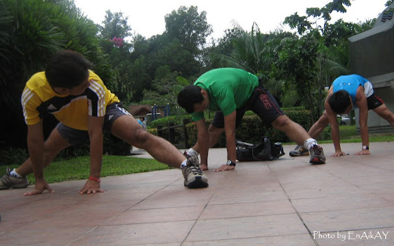
By 7.15am, many of them have turned up at the parking area where we promised to meet. Everyone was very excited for this run. Some of them were about to do their first time trail running. Very impressive effort indeed, as the trail we were about to do was tough, and the distance was quite far (about 14km). Kudos to them. We then started off our session with a group stretching

(Me excluded, I was only taking photos)
New lesson learnt here. All this while, when I do any stretching, never did I do anything longer than a count of ten seconds. But, Ian shared with us that the right way to stretch is to pull or push our muscles until they reach the first point of resistance (no need to push/pull so extensively), and hold it for 20 seconds. I will surely practice this from now onwards. The stretching session lasted for a good 15 minutes and by 0730hrs, it was time to roll out!


I once run a very short loop of this Kiara trail when I first run a trail, but what we ventured this time was much deeper and further, and more challenging. The twelve of us began our journey, trailing the slightly-muddy single track, headed by our main trail trekker, Daud.

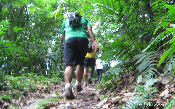
The first portion of the trail was pretty tough for me, as I remembered we were required to run on the tactical muddy and stony track, uphill all the way for the first 30minutes or so. And being a cameraman this time around, I tried my best to capture everybody in action, thus, requiring me to sometimes be at the most front and at the middle of the pack, and sometimes at the back. Torturously fun!
Too bad, due to poor lighting in the jungle and with the limitation on my digital camera, some of the photos turned up to be very blurry.


Since not everybody can run as fast as the front pack, we agreed to wait at every main junction ahead. Running trail can be a bit dangerous where one can easily lost track since we mainly focus our views looking down on the tracks we are running on, and not paying much attention on the surrounding and the direction.
That’s why I think to run a trail safely, the more runners the better. As for us, we did stop at main junctions, but when we came to smaller junctions along the route, at least one person from the front pack would wait and make sure the others at the back follow the right junction. This is a pretty same method when doing long distance cycling, when not everybody (especially those who cycle at the back pack) are familiar with the cycling route.

After the first junction, we started to run at a wider track where we could see some rubber trees. We also could start to enjoy some downhill trails. Such a relief after the strenuous uphill run we did earlier. From then onwards, the terrain were mix with up and down hills, and some little flat portions.


(Yes, I was only acting!)
I can’t really remember how many junctions we have taken, and I’ve lost track on the timing from one point to another. Out of a sudden, we came out to a bright area where to my surprise, I saw a highway and a glimpse of a toll plaza. Who knows, we were actually standing on top of the Penchala Link’s tunnel.

We then continued our run into a slightly thicker terrain. Some areas of the track were mainly covered with grass, dead leaves and small bushes, indicating that the trail has not been touched for quite a while. The jungle gets thicker too.
Not far later, we reached the first hut (pondok), and soon we reached another abandoned pondok at a point where we all thought the trail was blocked with a water pond. I could see a worried look on Daud’s face, but he went to back track left and right and confirming with the maps he hold that we can still proceed with another way around the water pond.


Finished with the steep climb, we reached an open space where we could see some housing construction taking place. I bet the foreign workers were surprised to see a group of people came out from one side of a jungle, crossing their construction area, and headed up to climb the staggered cliff to disappear again into another side of another jungle.


I was surprised again to get to another point with great scenery of Hartamas, Damansara and KL from the hill. We stopped for a while to catch another breather, hydrated ourselves, and fighting with the hungry mosquitoes having our blood as their breakfast.


We continued further and at this time, I was already so tired that I can’t think of which setting to select on my camera to get a good picture (i.e. to off the auto-flash, to select the sports-mode, etc). I kept on running with almost an empty fuel tank, but fully determined to capture few more photos of friends in action before I totally get bonked.
Refer back to the most top photo, where I had to stop to cool down my engine a little bit. This time it was not acting, I was really exhausted.
Few kilometers later, we arrived at an area full of fern trees. Daud said this area is known as the Twin Peak. Daud stopped here just so we can snap more group photos. Yeah, running in big group like this will assure you full of joy and excitements.

From then onwards, we were welcomed with more down hills. Good enough for the tired legs because we can make use of the gravity to help pull us running downwards. On our way down, we met few mountain bikers and as we passed each other, we smiled and greeted everyone to have a good, safe and enjoyable morning.

At last we reached the tarmac area, a familiar place for me as I’ve run few times here before. Just as I thought (actually I wished for it) we could make our way back to the park and end the run, they all decided to go the opposite side and dashed through another portion of trail. Nothing much I can do (takkan nak jerit-jerit protest pulak kan), I continued taking few more shots (and yes, while running with them lah).


These guys are good bunch of people. Kash and Rais brought us cold watermelons, Shuk sponsored a big ice box full of 100Plus can drinks and mineral water, Syah came with his chicken-dok (a version of cekodok, but filled with chicken) and Ian shared with us something from his Fitness Kitchen, the salad roll.

As always, we chit chat while filling up our hungry tummies, keeping track of what’s coming ahead and sharing experience and of course, laugh laugh laugh. I had to leave them early as I have to start playing my role as a weekend husband and daddy. My weekend had just started.
All in all, it was a good workout and good trail run training, and definitely a great fun! They’ll be arranging for monthly trail run similar to this (perhaps in different location), and by all means, all are invited to join.
My personal note: This is as good as a race event!
P/s: To see all the photos I took, go here.


15 comments:
indeed it was. and I am grateful for all your pics Nik... amazing how simple things are that much more gratifying, huh.
Keep it up bro!
Syah,
And i'm grateful to have cool friends like you all.
Thanks.
thanks a lot for the photos bro. i really had fun the other day...tak sabar nak trail lagi ni.
Shuk,
No problem. I had fun taking photo shots.
Yeah, we all know you've been infected with the TR bug. Keh keh keh...
(i know, coz i pun penah kena TR bug ni)
Bro, nice post & pix. Those u called "staggered cliffs" are named as engineered slopes. Those we climbed were probably cut slopes. Originally it was a hill but had to be cut to put the bungalow on flat platform.
The flat pathway which allowed us to walk with drain at side are called berms. Engineered slopes have to be formed at maximum height of 6 meters with one berm for stability. So, basically those we climbed were about 25 to 30 meters.
Dah macam lawatan teknikal la pulak. Sori. Hehe. Saja sharing.
congrats to all of u !! :P sure looks fun!
Shakhir,
Wah, i just learnt new things about civil engineering.
Thanks a lot for sharing.
That shows that no matter how much we know, there's always many other things we don't.
Let's share more!
Julie,
Thanks. Yes, it was fun!
Come and join us in the future ya!
ya juliz.. looks fun, especially the last part, got watermelon & stuff like dat =)
Fong,
Come and join us for future adventures ya! The more the merrier. Or, if u have other trails, let us know. Kita redah semua! :)
Jom redah trail kat batu dam, 1.5hr gitu;
Simply amazing!!!
Ü
OK Fong,
Ye, jom kita redah your training ground pulak!
U organize ye! :)
Rais,
Thanks. Next time, u'll be running with us ok!
mcm jauh aje
yg ni ke nak lari sabtu ni
semput la nak menghabiskannya
Pesa,
Yup... the Salomon 10km will be something like this la, but not exactly (coz we can't trace the full race track).
Be prepared!
Post a Comment